GERMANY - 2012-01-26 02:42:15
- Magnitude 2.7
Last update : 2012-04-27 16:46:51 Belgian time
Main parameters
| Date and time |
2012-01-26 02:42:15 UTC
2012-01-26 03:42:15 Belgian time |
| Type | Known induced event |
| Magnitude | ML 2.7 |
| Region | GERMANY |
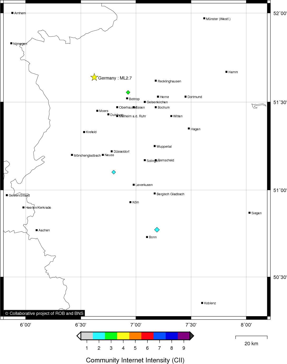
| Epicentral coordinates | 51.639° N, 6.624° E Uncertainty ± 6.2 km |
| Depth of hypocenter | 5.0 km |
Data source : ROB (Royal Observatory of Belgium)
Location map
Quake measurements
Measurements by the Belgian seismic network
| Station | Epicentral distance (km) |
P-Wave arrival (hh:mm:ss.ss) | S-Wave arrival (hh:mm:ss.ss) | Maximal ground displacement (nm) |
|
|---|---|---|---|---|---|
| Code | Place | ||||
| MEMH | MEMBACH | 122 | 02:42:34.01 | - | - |
| MEMS | MEMBACH | 122 | 02:42:34.05 | - | - |
| DSLB | DESSEL | 117 | 02:42:35.87 | - | - |
| MOLT | MOL | 117 | 02:42:36.20 | - | - |
| EBN | EBEN-EMAEL | 115 | 02:42:36.81 | - | - |
| STI | SART TILMAN | 139 | 02:42:37.50 | - | - |
| CLA | CLAVIER | 164 | 02:42:40.47 | - | - |
| GES | GESVES | 176 | 02:42:43.17 | - | - |
| RCH | ROCHEFORT | 192 | 02:42:47.12 | - | - |
| MRD | MAREDSOUS | 198 | 02:42:48.67 | - | - |
| DOU | DOURBES | 223 | 02:42:49.06 | - | - |
| WLF | WALFERDANGE | 222 | 02:42:50.71 | - | - |
| SKQ | STEENKERQUE | 209 | 02:42:51.11 | - | - |
Measurements by the Dutch seismic network of KNMI (Royal Netherlands Meteorological Institute)
| Station | Epicentral distance (km) |
P-Wave arrival (hh:mm:ss.ss) | S-Wave arrival (hh:mm:ss.ss) | Maximal ground displacement (nm) |
|
|---|---|---|---|---|---|
| Code | Place | ||||
| WTSB | WINTERSWIJK NEW | 38 | 02:42:20.59 | - | - |
| HGN | HEIMANSGROEVE | 109 | 02:42:32.31 | - | - |
| WIT | WITTEVEEN | 131 | 02:42:58.14 | - | - |
Macroseismic
Data
| Total number of responses | 4 |
|---|---|
| Intensity I | 1 |
| Intensity II | 1 |
| Intensity III | 2 |
Attention! The intensities derived from the macroseismic enquiry are raw unverified data.
Map
Data policy
Please read on this notice to learn more about our data policy.