KOBLENZ (DE) - 2011-02-14 17:23:32
- Magnitude 3.3
Last update : 2016-11-24 12:10:52 Belgian time
Main parameters
| Date and time |
2011-02-14 17:23:32 UTC
2011-02-14 18:23:32 Belgian time |
| Type | Earthquake |
| Magnitude | ML 3.3 |
| Maximal intensity | IV |
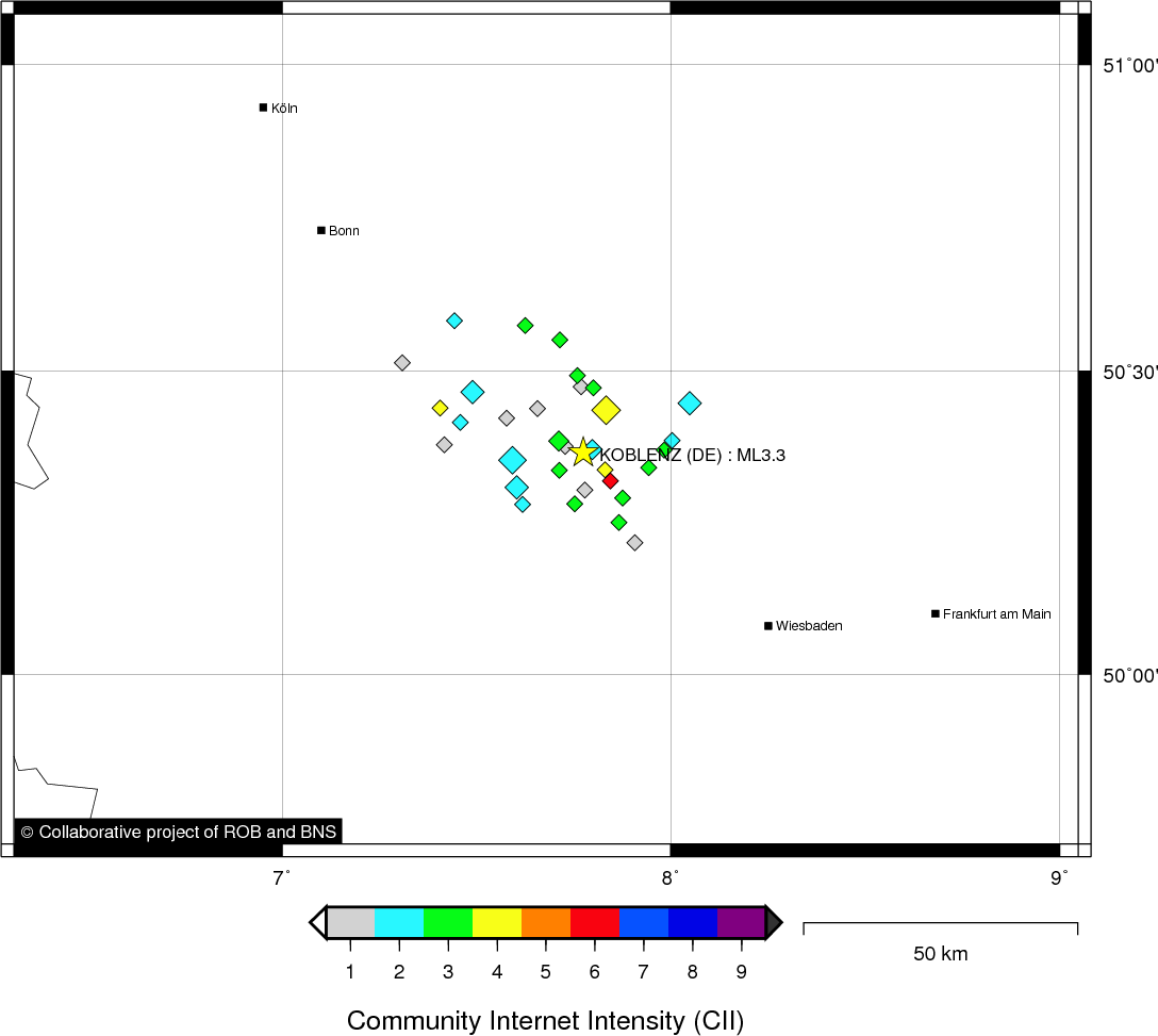
| Region | KOBLENZ (DE) |
| Epicentral coordinates | 50.366° N, 7.775° E Uncertainty ± 1.9 km |
| Depth of hypocenter | 5.0 ± 2.9 km |
Data source : ROB (Royal Observatory of Belgium)
Location map
Quake measurements
Measurements by the Belgian seismic network
| Station | Epicentral distance (km) |
P-Wave arrival (hh:mm:ss.ss) | S-Wave arrival (hh:mm:ss.ss) | Maximal ground displacement (nm) |
|
|---|---|---|---|---|---|
| Code | Place | ||||
| MEMS | MEMBACH | 128 | 17:23:54.41 | 17:24:09.64 | 449.1 |
| WLF | WALFERDANGE | 140 | 17:23:55.21 | 17:24:12.88 | - |
| EBN | EBEN-EMAEL | 156 | 17:23:58.04 | 17:24:16.46 | - |
| STI | SART TILMAN | 158 | 17:23:58.87 | 17:24:17.29 | - |
| CLA | CLAVIER | 176 | 17:24:01.36 | 17:24:21.02 | - |
| GES | GESVES | 191 | 17:24:03.19 | - | - |
| RCH | ROCHEFORT | 183 | 17:24:04.48 | - | - |
Macroseismic
Data
| Total number of responses | 51 |
|---|---|
| Intensity I | 12 |
| Intensity II | 11 |
| Intensity III | 20 |
| Intensity IV | 6 |
| Intensity V | 1 |
| Intensity VI | 1 |
Attention! The intensities derived from the macroseismic enquiry are raw unverified data.
Map
Data policy
Please read on this notice to learn more about our data policy.