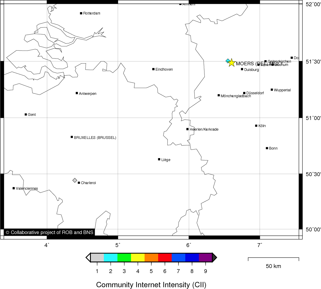
MOERS (DE) - 2011-08-05 06:01:07
- Magnitude 2.7
Last update : 2011-08-22 08:28:18 Belgian time
Main parameters
| Date and time |
2011-08-05 06:01:07 UTC
2011-08-05 08:01:07 Belgian time |
| Type | Known induced event |
| Magnitude | ML 2.7 |
| Region | MOERS (DE) |
| Epicentral coordinates | 51.486° N, 6.604° E Uncertainty ± 4.7 km |
| Depth of hypocenter | 7.4 ± 11.0 km |
Data source : ROB (Royal Observatory of Belgium)
Location map
Quake measurements
Measurements by the Belgian seismic network
| Station | Epicentral distance (km) |
P-Wave arrival (hh:mm:ss.ss) | S-Wave arrival (hh:mm:ss.ss) | Maximal ground displacement (nm) |
|
|---|---|---|---|---|---|
| Code | Place | ||||
| MEMH | MEMBACH | 106 | 06:01:25.49 | 06:01:38.74 | - |
| MEMS | MEMBACH | 106 | 06:01:25.53 | 06:01:38.87 | - |
| EBN | EBEN-EMAEL | 101 | 06:01:25.78 | 06:01:37.23 | - |
| MOLT | MOL | 110 | 06:01:26.28 | 06:01:39.89 | - |
Measurements by the Dutch seismic network of KNMI (Royal Netherlands Meteorological Institute)
| Station | Epicentral distance (km) |
P-Wave arrival (hh:mm:ss.ss) | S-Wave arrival (hh:mm:ss.ss) | Maximal ground displacement (nm) |
|
|---|---|---|---|---|---|
| Code | Place | ||||
| WTSB | WINTERSWIJK NEW | 55 | 06:01:17.14 | 06:01:24.80 | - |
| HGN | HEIMANSGROEVE | 93 | 06:01:23.73 | 06:01:35.08 | - |
Macroseismic
Data
| Total number of responses | 2 |
|---|---|
| Intensity I | 1 |
| Intensity II | 1 |
Attention! The intensities derived from the macroseismic enquiry are raw unverified data.
Map
Data policy
Please read on this notice to learn more about our data policy.